
How Does Google Maps Know a Business Is Busy?
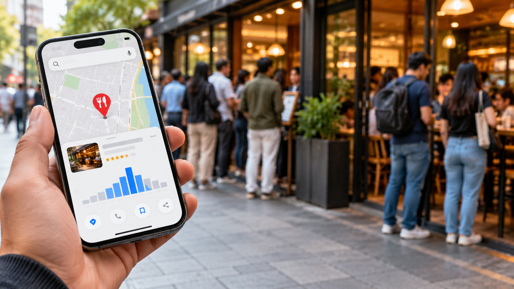
Have you ever checked Google Maps before visiting a restaurant, store, or other local business? You may notice a Popular Times graph or a live indicator showing how busy the place is. But how does Google Maps know a business is busy without someone counting customers?
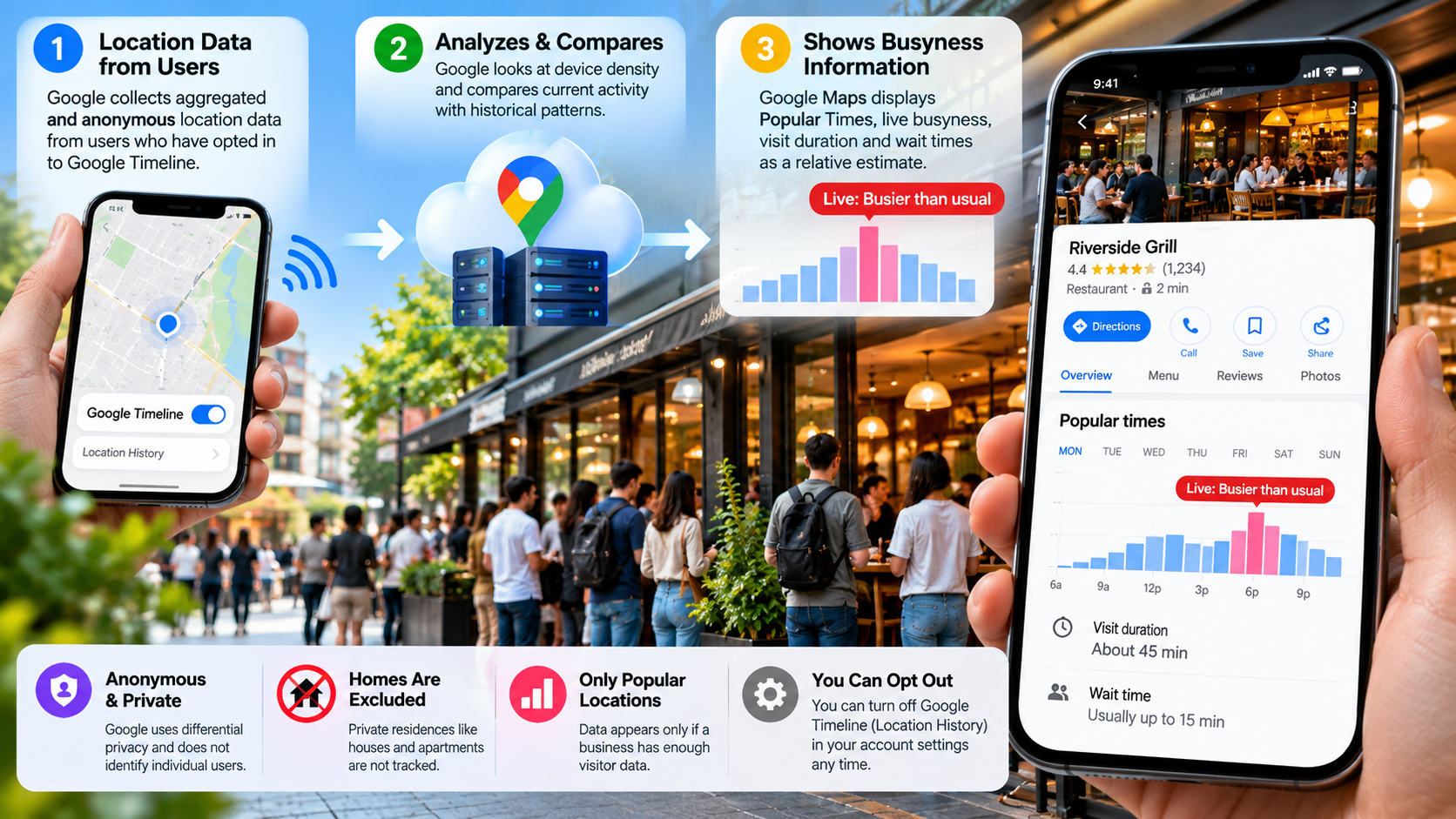
Google uses aggregated and anonymized location data from users who have opted into location sharing. It combines this information with historical visit patterns to estimate how active a business is at different times.
You can learn more about how Google collects and displays this information in its official guide to Popular Times, wait times, and visit duration.
This data helps Google estimate popular times, live activity, typical visit duration, and wait times. It can also help people decide when to visit a business or avoid a crowded period.
The system is not simply counting every person inside a building. Instead, Google analyzes patterns from qualifying location signals and compares current activity with historical trends.
How does Google know if a business is busier than usual?
Google can estimate whether a business is busier than usual by comparing current activity with its typical patterns. The information comes from aggregated and anonymized data from users who have opted into location sharing.
For example, imagine a restaurant that normally receives its highest number of visits between 7 PM and 8 PM. Google can compare current activity with the restaurant’s usual activity for that period.
The important point is that Google does not publish an exact customer count. It provides a relative indication of activity instead. Google also requires sufficient visit data before displaying these insights.
Understanding how does Google Maps know a business is busy also requires looking at how Google compares current activity with historical patterns. This comparison helps the service identify whether a location is experiencing unusually high activity.
Real-Time Anomaly Detection Algorithms
Google’s system can identify changes between current activity and historical patterns. This helps Maps show whether a location is more or less active than it normally is.
A sudden event can change normal patterns. A local festival, promotion, sporting event, or unexpected disruption may bring more visitors than usual. Google can use current location signals to detect these changes.
However, the exact algorithms and thresholds Google uses for individual businesses are not publicly documented in detail. Therefore, it is more accurate to describe the process as pattern analysis rather than assume a specific device-counting formula.
Google also applies privacy protections to its busyness information. The company uses privacy-preserving techniques and does not display information when there is insufficient data for an accurate, anonymous result.
This means the “busy” indicator is an estimate, not a precise headcount of everyone inside the business.
How does Google Maps know when it’s busy?
Google Maps uses historical visit patterns to determine when a business is usually busy. Popular Times information is based on average popularity over recent months. If you want to understand how Maps compares with Google’s other mapping platform, the difference between Google Maps and Google Earth is worth exploring.
For example, a restaurant may consistently receive more visits on Saturday evenings than weekday afternoons. Google can use those recurring patterns to build its Popular Times graph.
The system can also provide live visit data. This shows how active a location is at the current time compared with its usual activity. The information can change as current activity changes.
So, how does Google Maps know a business is busy at a particular time? It compares current location activity with the business’s established historical patterns. This produces a relative estimate rather than an exact number of customers.
Differential Privacy and Data Aggregation
Privacy is an important part of Google’s approach. Popular Times, wait times, and visit duration rely on aggregated and anonymized information from opted-in users.
Google also uses differential privacy for certain busyness information. This is designed to prevent published data from being used to identify individual users.
Google does not publish the exact number of people inside a business. It also avoids showing busyness information when there is not enough data to provide an accurate, anonymous estimate.
This is why some businesses may have a Popular Times graph while others do not. A location needs enough qualifying visit information before Google displays these insights.
Why doesn’t China allow street view?
Google Street View is not broadly available in mainland China, but the explanation is more complicated than simply saying that China “forbids Google Street View.”
China has strict rules governing surveying, mapping, geographic information, and online map services. Foreign organizations and individuals conducting surveying activities in China must follow applicable laws and regulations. These rules also cover activities involving geographic information and national security.
Chinese regulations also govern internet map services. Providers must meet relevant surveying and mapping requirements and use approved geographic information.
These regulatory requirements help explain why Google’s global Street View model cannot simply operate in mainland China in the same way it does in many other countries.
Restrictions on Foreign Geographic Surveying
China’s restrictions extend beyond ordinary street photography. Foreign organizations and individuals conducting surveying or mapping activities must comply with the country’s regulatory framework. The rules are connected to the control of geographic information and national security.
This matters because Street View requires the collection, processing, and publication of large amounts of geographic imagery.
China also has technical and regulatory requirements for digital mapping. Online map providers must use approved maps and comply with requirements governing geographic information.
As a result, users in mainland China generally rely on domestic mapping services for detailed local mapping and street-level imagery rather than Google’s standard Street View coverage.
It is therefore better to describe the situation as a regulatory and mapping-access issue rather than claim that one specific law simply bans all foreign street imagery.
How does Google detect traffic jams?
Google Maps can detect traffic slowdowns by analyzing aggregated location data from drivers and other sources. When people navigate with Maps, aggregated location data can help Google understand traffic conditions on roads. Drivers can also use Android Auto Gemini voice commands to interact with navigation features while driving.
Suppose vehicles on a highway normally travel at highway speeds. If many location signals show that movement has slowed sharply along the same road segment, Maps can recognize a developing congestion pattern.
The system can then use that information to show traffic conditions on the map. Google also combines live traffic information with historical traffic patterns to improve its predictions.
The same general principle helps explain how does Google Maps know a business is busy. In both cases, Google looks for patterns in aggregated location information rather than relying on a person to manually report every change.
Crowdsourced Incident and Hazard Reporting
Google Maps does not rely only on passive location data. User reports and authoritative information can also contribute to the traffic picture.
Drivers can report incidents such as crashes, road closures, construction, and other disruptions. Real-time user feedback and information from local authorities can help Maps understand changing road conditions.
Google also works with traffic authorities and local partners in some regions to provide information about road closures and other disruptions.
Combining these sources helps Google distinguish ordinary slow traffic from unusual road disruptions. It can then update the map and adjust route recommendations when conditions change.
How accurate is Google Maps for traffic?
Google Maps can provide useful traffic estimates, but accuracy is not guaranteed to be the same everywhere. Traffic conditions can change quickly because of crashes, road closures, weather, construction, or unexpected congestion. These factors are also useful to consider when learning through activities that make geography memorable.
Google improves its estimates by combining current traffic conditions with historical traffic patterns. The system analyzes historical road speeds and combines them with live conditions using machine learning.
This allows Maps to recognize recurring patterns. For example, a road may regularly become congested during the morning commute. Historical information can help the system anticipate that pattern when similar conditions occur.
However, sudden incidents can still make an estimate inaccurate. Rural roads can also provide less information when fewer devices contribute usable location signals.
Predictive Machine Learning Models
Google uses machine learning to predict how traffic may change during a journey. The system combines historical traffic patterns with current road conditions to estimate future congestion.
Google has also used advanced machine learning research to improve traffic prediction. Its models use historical traffic information alongside current conditions to generate predictions.
This means Google Maps is not simply looking at traffic at this exact moment. It can also consider how traffic usually behaves on the same roads.
The prediction can help Maps estimate travel times and select routes. Still, no traffic model can perfectly predict unexpected events. A crash, sudden road closure, severe weather event, or unusual crowd can change conditions within minutes.
For that reason, a Google Maps ETA should be treated as a dynamic estimate, not a guaranteed arrival time.