Activities That Make Geography Memorable: A Guide to Engaging Learning
Finding activities that make geography memorable can turn a dry subject into an exciting adventure. When learners interact with maps, cultures, and physical landscapes, abstract facts become lasting memories.
Geography is not only about memorizing capitals or tracing borders. It helps students understand our interconnected planet, diverse communities, and shared environments. The National Geographic Society highlights the importance of geographic literacy and spatial thinking.
Hands-on experiences can also make geography easier to understand. They give learners practical ways to explore ideas instead of simply reading about them.
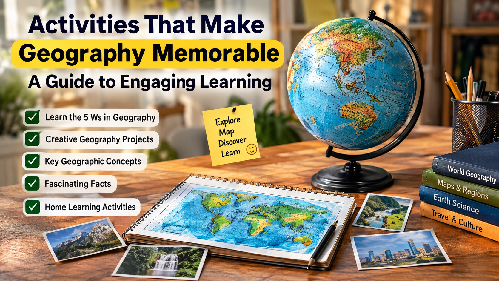
This guide explores the five Ws, creative geography projects, key geographic concepts, fascinating facts, and activities for home learning. These approaches can help children and students develop curiosity, spatial awareness, and stronger connections with the world around them.
What are the 5 Ws in geography?
The 5 Ws in geography give learners a simple framework for investigating places, regions, and global events. The questions are who, what, where, when, and why. Together, they turn geography from memorization into active inquiry.
Who focuses on people, communities, cultures, and populations connected to a place. What examines physical features, ecosystems, resources, industries, and landmarks. Where identifies absolute and relative location through coordinates, hemispheres, borders, and nearby places.
When adds historical and seasonal context. It helps learners examine how landscapes and communities change over time. Why explores causes behind migration, settlement, climate patterns, resource use, and economic activity.
Using the five questions also strengthens observation and critical thinking. Students can apply them to a country, city, river, mountain, or current event. This approach makes geographic information easier to organize, compare, and remember. It is especially useful when studying unfamiliar places.
Applying the Five Questions to Daily Studies
Applying the five questions to daily studies can make ordinary geography lessons more active and meaningful. Instead of memorizing isolated facts, learners investigate places like young researchers.
Take a major river as an example. Ask who lives along its banks and what communities depend on it. Then ask where the river begins, where it flows, and which regions it crosses. The when question can reveal how settlements developed around the river over time, much like studying Asian history through geography and place.
Finally, ask why people chose that location and why the river matters today. The answers may involve farming, transportation, drinking water, trade, or industry. This process connects physical geography with human geography.
The same method works with mountains, deserts, cities, and countries. Learners can write five short answers for each topic. They can also discuss their answers with family members or classmates. Regular practice builds stronger observation, comparison, research, and regional awareness skills.
What are some creative ideas for a geography project?
Creative geography projects help students understand places through making, exploring, and presenting information. A strong project should involve more than copying facts from a textbook.
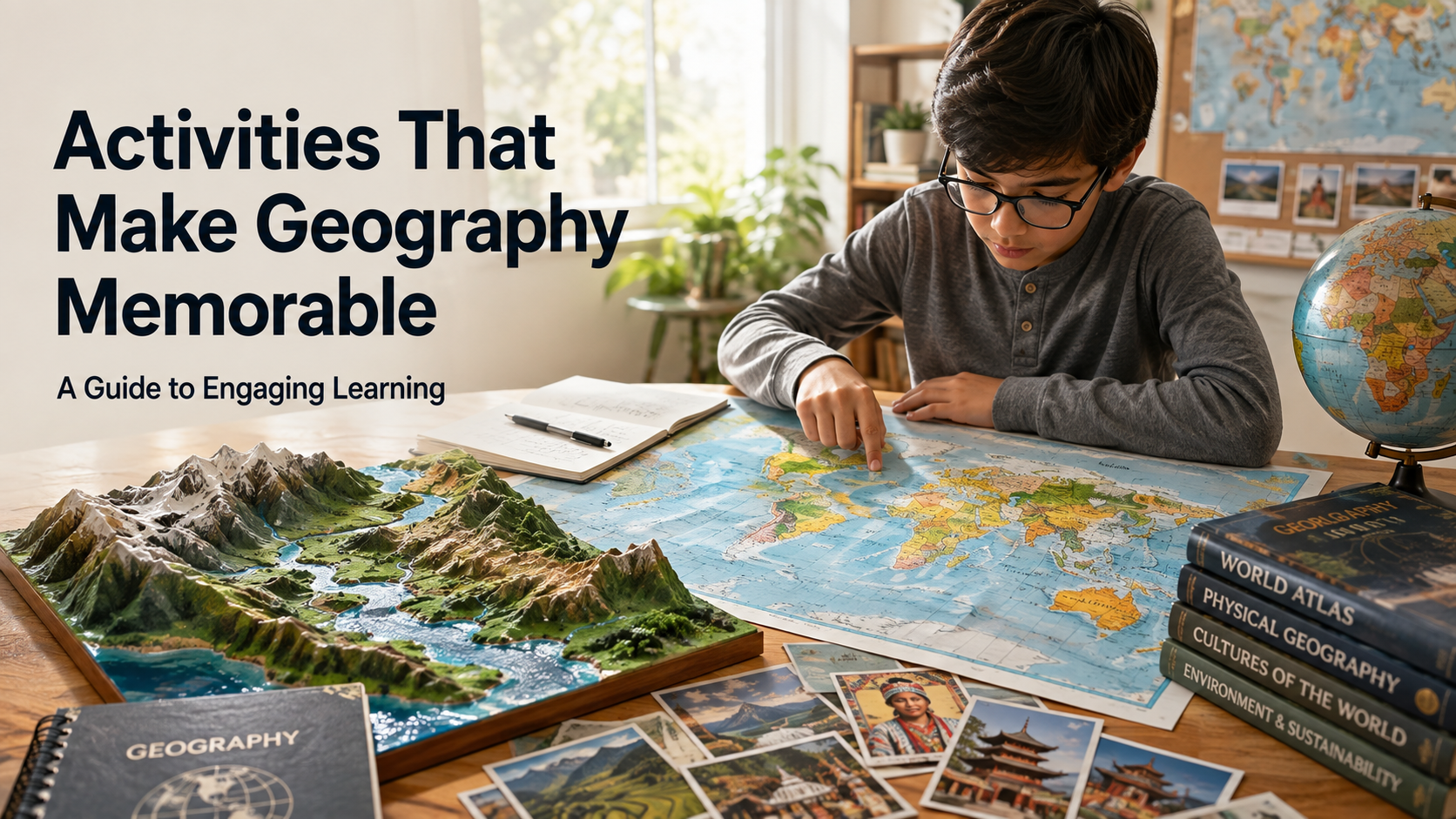
Students can build 3D topographic maps with salt dough, papier-mâché, cardboard, or recycled materials. These models can show mountains, valleys, rivers, plateaus, and coastlines. Another option is a travel vlog project, where students research a country and present its geography as a fictional journey, using ideas from places to visit around the world to make the project more engaging.
Cultural heritage boxes can include researched examples of food, music, clothing, crafts, languages, and currency. Students can also create digital maps that mark landmarks, cities, natural features, and travel routes. A food-based project can connect geography with agriculture, climate, trade, and culture.
The best project depends on the learner’s age and interests. Combining research with a physical or digital product gives students something concrete to remember. It also encourages creativity, communication, and independent learning.
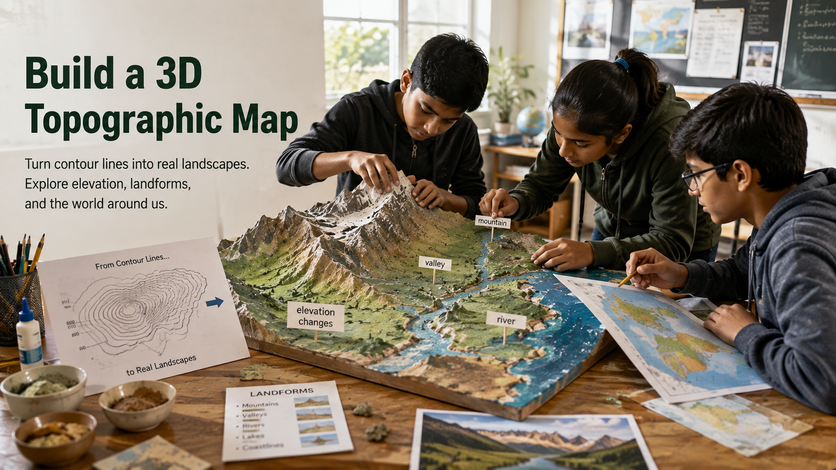
Building 3D Topographic Relief Maps
Building a 3D topographic relief map gives students a hands-on way to understand elevation and landforms. Instead of seeing height only through contour lines, learners can physically see changes in the landscape.
Start with a simple outline of a selected region. Use flour dough, papier-mâché, cardboard, or air-dry materials to create raised mountains and lower valleys. Add rivers, lakes, and coastlines after the main terrain is complete.
Students can label major features and use different textures to show elevation levels. This makes contour maps easier to understand later. For deeper learning, discuss how terrain affects settlement, farming, transportation, rainfall, and natural hazards.
Ask why cities often develop near rivers or flatter land. Connecting physical features with human decisions makes the model more than an art project. It becomes a practical geography lesson that supports spatial thinking and long-term recall.
What are the 7 key points of geography?
The seven key points of geography provide a useful framework for studying how places, people, and environments connect. They are location, place, human-environment interaction, movement, region, scale, and spatial organization.
Location asks where something exists. It can use exact coordinates or describe a feature relative to another place. Place focuses on the physical and human characteristics that make an area unique.
Human-environment interaction examines how people depend on, adapt to, and change their surroundings. Movement explores how people, products, resources, and ideas travel between places. Region groups areas that share characteristics such as climate, culture, language, or politics, including topics explored through climate-smart agriculture.
Scale helps learners compare local, national, and global patterns. Spatial organization examines how geographic features and activities are arranged across space.
Using these seven concepts during lessons can make research more organized. Students can apply them to a city, country, ecosystem, or global issue. This approach builds a fuller geographic picture and can complement different school board approaches to learning and education.
Understanding Human-Environment Interaction
Understanding human-environment interaction helps students see how people and natural systems influence one another. Human societies depend on land, water, minerals, forests, and climate. At the same time, human decisions can change those environments.
Students can explore examples such as farming, dam construction, urban growth, mining, and forest management. Each example raises questions about benefits, risks, and long-term effects. For instance, a dam can support electricity generation and water storage while also changing river ecosystems. Exploring tidal energy and underwater turbines can provide another example of how people use natural systems for energy.
People also adapt their homes, crops, transportation, and work patterns to local conditions. Studying these relationships helps learners understand why lifestyles differ across regions.
This topic works well with simple case studies. Choose one local example and compare it with another region. Ask what resources people use, what changes they make, and what consequences follow.
These discussions build environmental awareness and make sustainability easier to understand. They also connect physical geography with everyday human decisions.
What are 5 interesting facts about geography?
Five interesting geography facts can turn a routine lesson into a memorable exploration. First, Earth is slightly wider around the equator than from pole to pole. Its rotation contributes to this shape.
Second, the Pacific Ocean covers an enormous area and is larger than all of Earth’s land area combined. Third, Angel Falls in Venezuela has a total height of about 979 meters, making it the world’s highest uninterrupted waterfall.
Fourth, the Dead Sea lies far below sea level and has extremely salty water. Its high salinity makes floating easier than in ordinary seawater. Fifth, Mount Everest continues to change because tectonic plates remain active beneath the region.
Students can investigate Earth’s shape, ocean geography, waterfalls, elevation, salinity, and plate tectonics. Ask learners to locate each feature on a map before researching it.
This small step connects fascinating trivia with spatial skills. The goal is to understand the geographic processes behind these memorable facts.
The Wonder of Extreme Elevations
Extreme elevations reveal how dramatically Earth’s surface can change over relatively short distances. High mountains, deep ocean trenches, plateaus, and low-lying basins all provide useful examples for geography learners.
The Himalayas show how tectonic movement can create enormous mountain ranges. In contrast, ocean trenches demonstrate how the seafloor can descend thousands of meters below the surrounding ocean. Comparing these extremes helps students visualize Earth’s vertical scale.
Learners can create an elevation chart or compare several locations using maps. They can also investigate how altitude affects temperature, vegetation, farming, transportation, and settlement. These connections show that elevation is not simply a number.
Extreme environments also provide opportunities to study adaptation. Communities living at high altitudes may adjust clothing, housing, farming methods, and daily routines. They can compare these adaptations with life in lowland or coastal areas.
When students connect elevation with climate, geology, and human activity, the topic becomes easier to remember. It also provides a clear introduction to plate tectonics and geological change.
Activities that make geography memorable at home
Activities that make geography memorable at home can turn everyday family time into practical learning. The key is to connect geographic ideas with activities involving movement, discussion, food, maps, or real-world choices.
Cooking international meals is one simple option. Choose a country, research its climate and agriculture, and prepare a traditional dish. Geography board games and family trivia can reinforce flags, landmarks, capitals, and locations without feeling like formal study.
A neighborhood scavenger hunt can introduce basic cartography. Give learners a simple map and ask them to locate roads, parks, shops, or landmarks. They can later create their own maps and add directions or symbols.
Families can also explore virtual maps, plan imaginary trips, or compare weather across countries. A pen pal relationship can add another layer through direct cultural exchange. Planning an imaginary journey can also introduce learners to travel in East India and the Seven Sisters.
These activities work because they connect information with memorable experiences. Short, regular activities are often easier to maintain than long study sessions. Even short activities can build curiosity and spatial awareness.
Cooking International Meals Together
Cooking international meals together turns geography into a sensory learning experience. Food provides a natural connection between climate, agriculture, trade, culture, and daily life.
Choose one country each week and begin with simple research. Find out which crops grow there and how the local climate supports them. Then explore how geography influences ingredients, cooking methods, and regional food traditions.
For example, learners can investigate whether a dish depends on rice, wheat, seafood, spices, dairy, or locally grown vegetables. They can locate the country on a map and identify nearby seas, mountains, rivers, or neighboring regions. This creates connections between physical and cultural geography and can introduce students to foods from medieval times and their geographic origins.
Ask children to prepare a small presentation while the meal is cooking. They can share the country’s location, climate, foods, and cultural background. Keep the activity focused on learning rather than treating one dish as representative of an entire country.
Repeating the activity with different regions helps learners notice similarities and differences. Food becomes a memorable entry point for understanding how people and places influence one another.
FAQ SECTION
Conclusion
Exploring the world around us through creative approaches ensures that learning remains an exciting, lifelong adventure. By integrating the 5 Ws, hands-on projects, key geographic points, fun facts, and home activities, we build deep global awareness. Activities that make geography memorable spark curiosity, encourage critical thinking, and foster genuine empathy for diverse cultures. Whether you are sculpting a mountain out of dough or cooking a foreign recipe, every small step matters. We encourage you to try out these engaging ideas in your home or classroom starting today. Embrace the wonder of our planet, ask questions fearlessly, and watch as the world opens up wonderfully.