
Why Don’t Clouds Fall Down? The Physics of the Sky
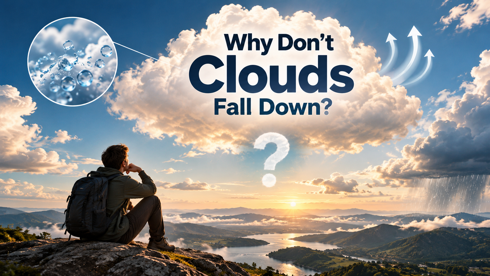
When you look up at a fluffy cumulus cloud, it can seem like a weightless puff of cotton. In reality, a typical cloud can contain hundreds of tons of water. This raises an obvious question: why don’t clouds fall down to Earth?
The answer lies in the tiny size of cloud droplets, air movement, and the water cycle. According to the National Oceanic and Atmospheric Administration, clouds form when water vapor cools and condenses into microscopic water droplets or ice crystals. These particles are extremely small and fall very slowly through the air.
At the same time, rising air currents help keep cloud particles suspended. Droplets also continuously evaporate and reform, creating a constantly changing cloud rather than a solid mass.
This guide explains why clouds float, what happens when clouds reach the ground, whether humans can touch them, and which cloud colors and types can signal severe weather.
Why are clouds not falling down?
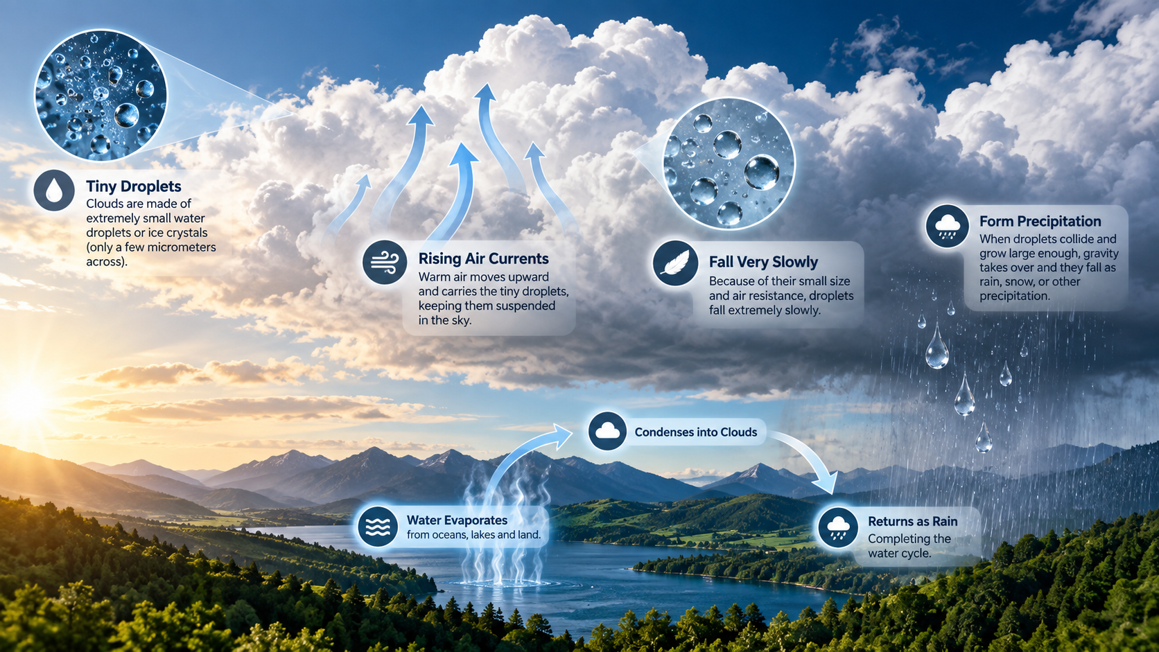
Clouds do not simply fall from the sky because their water droplets and ice crystals are incredibly small. Many cloud droplets measure only a few to several tens of micrometers across. At this scale, gravity makes them fall slowly, while air resistance strongly affects their movement.
Rising air also helps keep these particles suspended. Warm air near Earth’s surface becomes less dense and rises. As it moves upward, it can carry moisture into cooler parts of the atmosphere. That moisture then condenses and forms visible cloud droplets or ice crystals.
Clouds also constantly change. Droplets evaporate, condense, merge, and sometimes freeze. This means a cloud is not one solid object being held up by air. It is a constantly changing mixture of air and suspended particles.
When droplets become large enough, gravity takes over. They fall as rain, snow, or other precipitation.
The Role of Updrafts and Air Resistance
Rising air currents play an important role in keeping cloud droplets suspended. Strong updrafts can carry tiny droplets upward, especially inside developing storm clouds. However, updrafts are not the only reason clouds appear to float.
Cloud droplets have very little mass compared with their surface area. This creates significant air resistance, which slows their downward movement. A tiny droplet can therefore remain suspended for a long time, even while gravity constantly pulls it downward.
In ordinary clouds, gentle air movement and turbulence help distribute droplets throughout the cloud. Droplets also evaporate and reform as atmospheric conditions change. This continuous process makes a cloud appear stable even though its individual particles are constantly moving.
When droplets collide and combine, they become larger and heavier. Eventually, their falling speed becomes greater than the surrounding upward airflow. At that point, they leave the cloud as precipitation.
So, if you are wondering why don’t clouds fall down, the answer involves particle size, air resistance, and moving air. Together, these factors keep cloud droplets suspended until they grow large enough to fall.
Could we live without clouds?
Earth would be dramatically different without clouds. Clouds help regulate the planet’s energy balance, influence temperatures, and move water through the atmosphere. They are an essential part of the global water cycle.
During the day, clouds can reflect a significant amount of incoming sunlight back into space. This cooling effect helps limit how much solar energy reaches Earth’s surface. At night, clouds can also slow the loss of heat from the surface by absorbing and re-emitting some outgoing infrared radiation.
Clouds are equally important for freshwater distribution. Water evaporates from oceans, lakes, and land before moving through the atmosphere. It later condenses into clouds and returns to the surface as precipitation.
Without this process, many areas would receive far less rainfall. Rivers, lakes, forests, farms, and ecosystems would face severe water shortages.
However, Earth’s climate would not simply become uniformly hotter without clouds. Their effects vary by location, altitude, season, and cloud type. Even so, removing clouds would cause major changes to weather, climate, and the water cycle.
The Critical Balance of Planetary Albedo
Clouds influence Earth’s albedo, which describes how much incoming sunlight the planet reflects back into space. Bright clouds can reflect substantial solar energy, especially when they are thick and widespread.
This reflection reduces the amount of sunlight absorbed by Earth’s surface and atmosphere. As a result, clouds can produce a cooling effect during daylight hours. However, clouds also trap some outgoing heat, creating a warming effect, particularly at night.
The overall impact depends on cloud height, thickness, coverage, and particle properties. Low, thick clouds generally reflect more sunlight. High, thin clouds can have a stronger warming influence because they allow much sunlight through while absorbing outgoing infrared radiation.
This balance is one reason clouds matter so much in Earth’s climate system. Removing them would not simply remove shade. It would alter the planet’s energy balance and disrupt established weather patterns, raising broader questions explored through the biggest predictions in the field of physics.
Therefore, understanding cloud albedo helps explain why clouds are far more important than their soft appearance suggests. They actively influence temperatures, rainfall, and atmospheric circulation.
What is the most feared cloud?
The cumulonimbus cloud is among the most dangerous cloud types because it can produce severe and rapidly changing weather. These towering clouds are commonly known as thunderstorm clouds or thunderheads. Understanding these extreme atmospheric phenomena also connects to some of the biggest unanswered questions in physics.
Cumulonimbus clouds can extend many kilometers upward and sometimes reach the tropopause. Their powerful updrafts allow them to grow vertically at remarkable speeds. Inside the cloud, strong updrafts and downdrafts create intense turbulence and rapidly changing conditions.
Severe cumulonimbus storms can produce lightning, heavy rain, large hail, damaging winds, flash flooding, and tornadoes. Not every cumulonimbus cloud produces all these hazards, but strong storms can become extremely dangerous.
Aviation authorities treat severe thunderstorms with particular caution. Pilots generally avoid flying through cumulonimbus clouds because of turbulence, hail, icing, lightning, and strong vertical air currents. These hazards can threaten aircraft and passengers.
For people on the ground, severe thunderstorms can also become dangerous within minutes. Recognizing warning signs and following official weather alerts are essential parts of severe weather safety.
Anatomy of a Severe Thunderhead
A severe thunderstorm can develop a complex internal structure. Strong warm, moist air rises rapidly through the storm’s updraft. This rising air feeds continued cloud growth and can carry water droplets and ice high into the atmosphere.
Some powerful thunderstorms develop an overshooting top. This occurs when a strong updraft pushes the cloud top above the surrounding anvil. The feature can indicate particularly vigorous convection.
Inside the storm, precipitation eventually becomes heavy enough to create powerful downdrafts. These descending currents can produce damaging straight-line winds and microbursts. A microburst is a concentrated downward current that spreads outward after reaching the ground.
Some storms also develop rotating updrafts called mesocyclones. Under the right atmospheric conditions, these rotations can support tornado development.
The combination of strong updrafts, downdrafts, ice, water, and electrical activity makes cumulonimbus clouds highly dynamic. Their dramatic appearance reflects powerful atmospheric processes occurring inside the storm.
What would happen if a cloud fell to Earth?
If a cloud somehow descended to Earth’s surface, it would not crash into the ground like a solid object. Instead, people would experience something similar to fog or mist. A cloud is not a single physical mass. It consists mainly of air containing tiny suspended water droplets or ice crystals.
Mountains often provide a natural example. When a cloud moves across a mountain slope, people can find themselves inside the cloud. From the ground, this condition is usually described as fog.
Clouds also contain surprisingly little liquid water for their enormous size. A typical cloud may contain around half a gram of liquid water per cubic meter of air, although the amount varies widely.
Even if the water in a large cloud condensed rapidly, it would not create a huge solid object. The water would instead fall as precipitation and spread across the surrounding area.
So, there would be no massive impact if a cloud reached the ground. You would simply become surrounded by humid air and suspended droplets. In practical terms, a “fallen cloud” is just fog.
Visualizing Low-Altitude Cloud Contact
Mountain climbers often experience what seems like a cloud falling around them. When a mountain summit enters a cloud, visibility can suddenly decrease. The surrounding air may also feel cool and damp.
This happens because the climber has physically entered the cloud itself. The visible white surroundings consist of microscopic droplets suspended throughout the air.
The experience demonstrates an important fact about cloud formation. Clouds are not solid objects floating above Earth. They are regions of moist air where water has condensed into droplets or ice crystals.
At lower elevations, the same process creates fog. Meteorologically, fog and clouds are closely related. The main difference is their location relative to Earth’s surface.
This is why a cloud can appear enormous from a distance but seem almost insubstantial when you enter it. The droplets are spread through a huge volume of air.
The next time a mountain disappears into a cloud, there is no need to imagine the cloud falling. The mountain has simply moved into the atmospheric region where the cloud exists.
Can you physically touch a cloud?
Yes, humans can physically experience a cloud by entering it. Mountain hikers, pilots, and people walking through dense fog can all encounter conditions where they are surrounded by cloud droplets.
However, a cloud does not feel like a solid object. Its droplets are extremely small and widely dispersed through the surrounding air. Your hand will not find a surface or a cotton-like structure.
Instead, you may feel cool, damp air as tiny droplets settle on your skin, hair, or clothing. The experience is similar to walking through thick fog on a chilly morning.
The reason clouds look solid from a distance is largely an effect of light and perspective. Billions of tiny droplets collectively scatter sunlight, making the cloud appear bright, dense, and substantial.
In reality, there is no physical boundary that you can grab. You simply move from clearer air into air containing enough suspended droplets to become visible.
So, while you can technically “touch” a cloud, you cannot hold one. The cloud is an atmospheric region rather than a solid object.
The Reality of Cloud Density
Clouds can look massive, but their liquid water content is surprisingly low. A large cloud occupies an enormous volume of air, while its water is distributed among countless microscopic droplets.
This explains why standing inside a cloud does not feel like entering a giant pool of water. Most of the cloud is still ordinary air. Only a small fraction consists of condensed water or ice.
The droplets remain separated by air and constantly move with surrounding currents. Some evaporate while others form or grow. This ongoing exchange gives clouds their changing shapes and constantly shifting edges.
The amount of water in a cloud varies significantly. Some clouds contain relatively little liquid water, while powerful storm clouds can contain much more.
Even so, the water is distributed over such a large volume that the cloud does not become a solid mass. This low density is another important part of understanding why clouds float.
What looks like a giant white object in the sky is therefore better understood as a moving region of moist air filled with microscopic particles.
What is the rarest cloud color?
Green is one of the rarest and most striking colors associated with severe thunderstorms. A greenish appearance can occur when sunlight passes through a thick region of water and ice within a powerful cumulonimbus cloud.
The effect depends on several factors, including the storm’s structure, the amount of water and ice present, and the angle of sunlight. Late afternoon or evening light can make the coloration particularly noticeable.
A green sky or cloud does not guarantee that a tornado is forming. However, greenish coloration can occur in intense storms that also produce large hail and other severe weather. For this reason, an unusual green appearance should be treated as a reason to pay attention to official weather warnings.
Cloud color alone cannot reliably identify a specific hazard. Observers should consider radar information, warnings, storm movement, and other visual signs.
Understanding unusual cloud colors can still help people recognize that a storm may be intense. If a thunderstorm develops a strange green tint, seek reliable weather information rather than relying on appearance alone.
The Optics Behind Green Storms
The green appearance of some thunderstorms results from light scattering and filtering within a thick storm cloud. Sunlight contains many wavelengths, and water droplets and ice particles interact with that light as it passes through the storm. These optical effects are also relevant when observing distant objects with the biggest telescopes.
The exact color depends on the sun’s position and the storm’s internal structure. A thick cloud containing large amounts of water and ice can change how different wavelengths reach an observer.
The effect can become especially dramatic when the sun is low near the horizon. Light then travels through a longer path across the atmosphere and through the storm’s dense precipitation region.
Although green clouds are sometimes associated with tornadoes, the color itself does not predict tornado formation. Severe hail, heavy precipitation, and storm depth can contribute to the appearance.
Therefore, a green sky should not be treated as a guaranteed tornado warning. Instead, it is a visual clue that may accompany a strong thunderstorm.
When severe weather is nearby, official alerts and weather radar provide much more reliable information than cloud color alone.
Frequently Asked Questions
How high up do most clouds float in the sky?
To understand why don’t clouds fall down, remember that most clouds form within the troposphere. Low clouds generally remain below 6,500 feet, while mid-level clouds can reach 20,000 feet. High cirrus clouds may form above 20,000 feet in extremely cold conditions.
Do clouds move fast, and what drives their speed?
The answer to why don’t clouds fall down also involves atmospheric movement. Clouds are carried by winds at different altitudes, so their speed varies considerably. Strong upper-level winds and jet streams can move high clouds at speeds exceeding 100 miles per hour.
Can clouds exist on other planets in our solar system?
Learning why don’t clouds fall down becomes even more interesting on other planets. Clouds exist on Venus, Jupiter, and Saturn, but their composition differs from Earth’s. Venus has sulfuric acid clouds, while gas giants contain cloud layers involving substances such as ammonia, methane, and water.
How do airplanes interact when flying through clouds?
Knowing why don’t clouds fall down helps explain why aircraft can safely travel through them. Airplanes routinely fly through clouds, although pilots may encounter turbulence, icing, and reduced visibility. Commercial aircraft use weather radar, instruments, and established safety procedures to manage these atmospheric conditions.
Conclusion
Understanding why don’t clouds fall down reveals how tiny droplets, buoyant air, gravity, and atmospheric motion work together. The answer to why don’t clouds fall down is not that clouds are weightless, but that their microscopic droplets remain suspended within moving air. Ultimately, why don’t clouds fall down shows how delicate atmospheric forces maintain Earth’s familiar skies.