
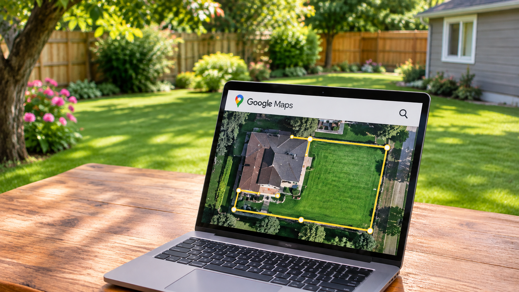
How to Use Google Maps to Measure Your Yard and Property
Knowing your yard dimensions is useful for several home improvement projects. You might need measurements when ordering mulch, planning a fence, or estimating landscaping costs. Accurate estimates help you avoid purchasing too much or too little material.
In this guide, we explain how to use Google Maps to measure your yard, specific objects, and property boundaries. You will also learn how to measure land using your smartphone. Finally, we compare Google Maps, Google Earth, and other free land measurement apps.
How do I use Google Maps to measure my yard?
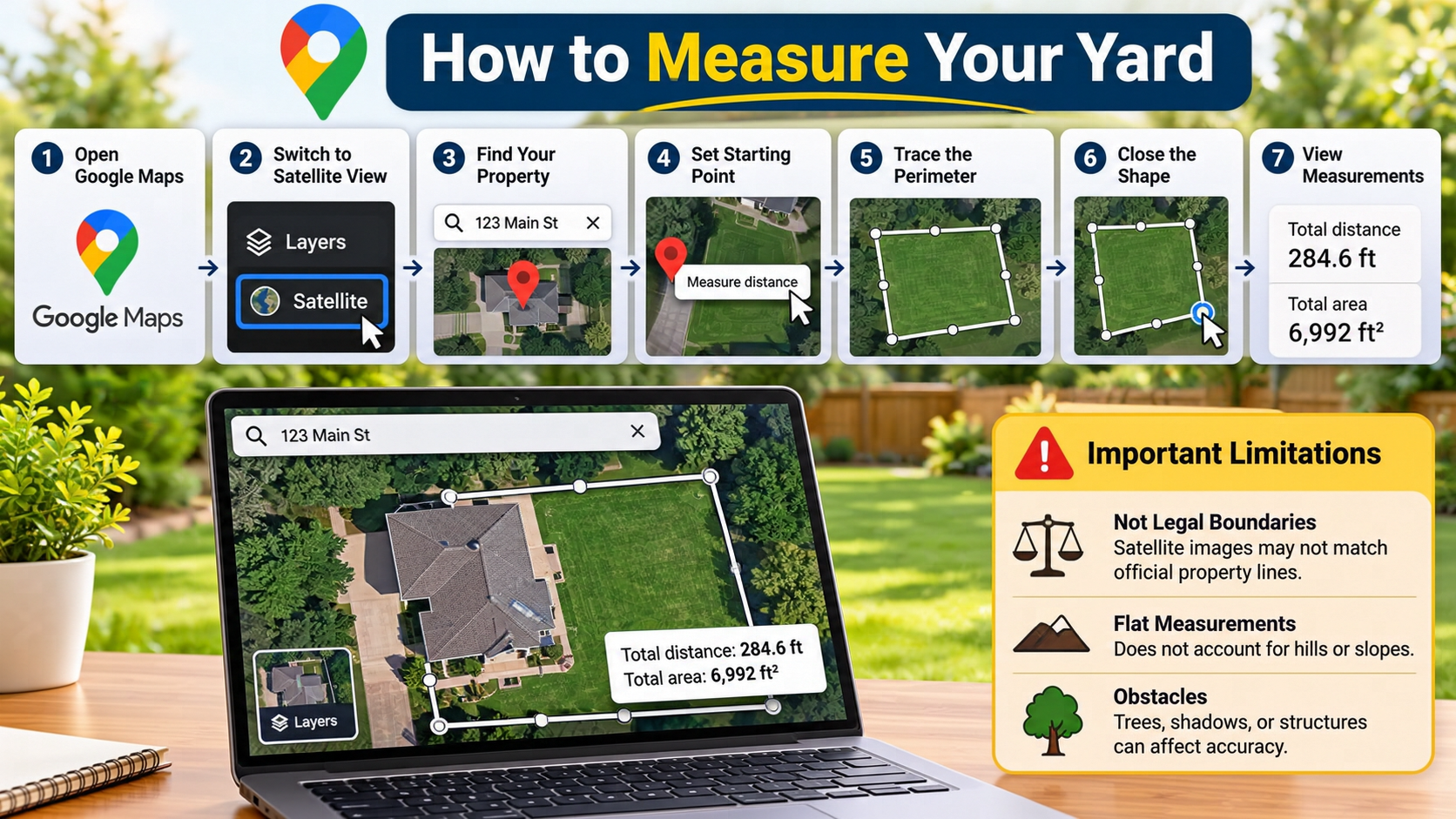
You can use Google Maps to measure distances around your yard directly from your desktop browser. Start by opening Google Maps and entering your home address. Switch to Satellite view using the Layers option. This makes it easier to identify your lawn, driveway, sidewalks, and visible property features.
Zoom in until you can clearly identify the boundaries you want to measure. Right-click on your starting point and select “Measure distance.” Next, click along the edges of your yard to create a connected measurement line. Add more points whenever the boundary changes direction.
Google Maps displays the total distance between your selected points. You can use this information to estimate the length of fences, garden borders, or pathways. However, Google Maps does not officially document an area-calculation feature in its standard distance measurement instructions. For square footage or acreage, Google Earth is a better option.

Zooming in for sharp yard boundaries
Satellite imagery provides a useful overhead view of your outdoor space. However, the quality of your measurement depends on how clearly you can identify the boundaries. Zoom in before placing your first measurement point. This helps you avoid selecting the wrong location.
Pay attention to trees, shadows, fences, and nearby structures. These features can hide the actual edges of your lawn. A building’s roofline may also extend beyond its ground-level walls. Therefore, avoid using roof edges as substitutes for property boundaries.
For better results, follow visible ground features whenever possible. Look for sidewalks, fences, garden borders, and pavement edges. Place your measurement points as close to these boundaries as the imagery allows.
Also, remember that satellite images may not show recent construction or landscaping changes. If your yard has changed recently, compare the imagery with what you can see on the ground. This will help you produce a more useful estimate.
How to use Google Maps to measure something?
Google Maps makes it easy to measure the distance between two locations. You can also measure longer paths by adding multiple points. Open Google Maps on your computer and locate the object or area you want to measure.
Right-click on the starting location and select “Measure distance.” A measurement point will appear on the map. Next, click the ending location to create a straight measurement line. Google Maps displays the total distance in miles or kilometers.
You can also measure longer objects by adding extra points. This works well for driveways, garden paths, sidewalks, and other outdoor features. Each additional point extends the measurement line.
For curved objects, place several points along the curve instead of measuring from one end to the other. This provides a closer estimate of the actual length. Remember that the tool measures distances between map points, not driving or walking routes. Use Google Maps Directions when you need road-based travel distances.
Adjusting points for curved paths
Straight measurement lines cannot accurately represent every outdoor feature. Driveways, garden borders, and walking paths often contain bends and curves. To measure these features more accurately, add several points along their edges.
Start by placing your first point at one end of the path. Then, click at each major turn or change in direction. Continue adding points until you reach the other end. Google Maps combines the individual segments and displays their total distance.
You can also adjust existing measurement points when necessary. Click and drag a point to move it closer to the actual boundary. This helps correct mistakes without starting the measurement again.
For smoother curves, use more points around the bends. However, avoid adding unnecessary points along straight sections. A few carefully placed points usually provide a practical estimate for everyday projects.
Is there a way to measure a property on Google Maps?
Yes, Google Maps can help you estimate the distance around your property. Its measurement tool lets you mark multiple points along visible boundaries. This is useful when planning fences, landscaping, or outdoor improvements.
Open Google Maps, search for your property, and switch to Satellite view. Right-click on one corner and select “Measure distance.” Follow the visible boundary by clicking each corner. Continue until you reach the opposite end of the property.
The measurement card displays the combined distance of your selected points. This gives you an estimate of the property’s perimeter. However, do not assume this number represents the property’s total area.
For square footage or acreage, use Google Earth instead. Its measurement tool supports enclosed shapes and displays their area and perimeter. Remember that satellite-based measurements are estimates. They cannot replace an official land survey or legally verified property records.
Understanding satellite imagery limits
Satellite imagery provides a convenient way to inspect your property from above. However, it has limitations that can affect measurement accuracy. Images may contain shadows, unclear boundaries, and outdated information. Some locations may also appear intentionally blurred on Google Maps for privacy or security reasons. Tall buildings and trees can also make ground-level features difficult to identify. You can explore why some locations are blurred out on Google Maps to understand this feature better.
Another important issue is image perspective. Buildings and other tall structures may appear slightly displaced in satellite imagery. This can make their visible edges differ from their actual ground positions.
Follow visible ground features whenever possible. Existing fences, sidewalks, curbs, and clearly marked boundaries can help you identify measurement points. Avoid relying entirely on rooflines or tree shadows.
Google Earth also explains that its measurements are estimates. They do not account for elevation changes. For everyday landscaping, these estimates can be useful. However, always consult a qualified land surveyor when you need accurate legal property boundaries.
Can I measure land with my phone?
Yes, you can use your smartphone to measure distances with the free Google Maps app. The process works on both Android and iPhone devices. It is particularly useful when you are away from your computer or inspecting an outdoor area.
First, open Google Maps and search for your location. Switch to Satellite view using the Layers icon. Touch and hold an unlabeled location on the map until a red pin appears. Open the location information panel and select “Measure distance.”
A crosshair will appear on the map. Move the map until the crosshair reaches your next measurement point. Tap “Add point” to record that location. Repeat these steps to measure additional sections of your yard.
Google Maps displays the combined distance of your selected points. You can use this measurement to estimate fence lengths, pathways, and other outdoor features. For calculating enclosed land area on a smartphone, use Google Earth. Its mobile measurement tool supports area calculations when you close the shape.
Navigating mobile crosshairs smoothly
Measuring distances on a touchscreen requires a slightly different approach. Unlike desktop measurements, you do not tap every location directly. Instead, you move the map underneath a stationary crosshair.
Start by zooming in on the area you want to measure. Position the crosshair over your first target location. Then, drag the map slowly until the crosshair reaches your next point. Tap “Add point” to record the measurement.
Follow these tips for better results:
- Zoom in first: This makes small boundaries easier to identify.
- Move slowly: Avoid accidentally placing points in the wrong locations.
- Follow the edges: Keep your points aligned with visible boundaries.
- Use Undo: Remove the last point if you make a mistake.
- Check the total: Review the displayed distance before finishing.
Practising these steps makes mobile measurements easier. For complex property shapes, Google Earth provides a more suitable area measurement tool.
What is the best free app for measuring land area?
Google Earth is one of the best free options for measuring land area. It offers dedicated tools for measuring distances, paths, polygons, and property boundaries. Unlike the standard Google Maps distance tool, Google Earth can calculate the area of an enclosed shape.
You can use Google Earth on your computer or compatible smartphone. Open the app, search for your property, and select the Measure tool. Add points around the boundary of your land. Close the shape by connecting the final point to the starting point. Google Earth then displays the estimated area and perimeter.
Other options include GPS Fields Area Measure and Planimeter. These apps offer different measurement features, depending on their versions and available plans. Some support GPS-based measurements, saved projects, or area calculations.
Before choosing an app, consider what you need to measure. For quick distance checks, Google Maps is convenient. For estimating square footage or acreage, Google Earth is a practical starting point.
Choosing between Google Maps and Google Earth
Google Maps and Google Earth both help you understand distances and locations. However, they serve slightly different measurement purposes. If you are unsure which tool suits your needs, understanding the differences between Google Maps and Google Earth can help you choose the right measurement option.
Google Maps is suitable for quick distance measurements. You can mark multiple points to calculate the combined length of a driveway, fence, or walking path. Its familiar interface also makes simple measurements easy.
Google Earth is more suitable when you need detailed land measurements. Its dedicated measurement tool supports enclosed shapes, area calculations, and perimeter estimates. You can also use it to measure larger plots of land.
Here is a simple comparison:
- Google Maps: Best for quick distance and path measurements.
- Google Earth: Best for estimating land area and perimeter.
- GPS Fields Area Measure: Useful for GPS-based field measurements.
- Planimeter: An alternative for map-based distance and area calculations.
For most homeowners, Google Maps is a convenient starting point. Choose Google Earth when you need square footage or acreage estimates.
Conclusion
Measuring your yard or property doesn’t have to involve expensive equipment or complicated calculations. With Google Maps, you can quickly measure distances, estimate fence lengths, and plan outdoor projects from your computer or smartphone. For calculating land area, square footage, or acreage, Google Earth offers more suitable measurement tools. You can follow the official Google Earth measurement guide to learn how to measure distances and areas accurately.
Before making important landscaping or construction decisions, remember that satellite measurements are estimates. Always verify critical dimensions on the ground, especially when dealing with property boundaries.
Whether you’re planning a new fence, improving your garden, or estimating landscaping materials, these free tools can help you get started. Choose the right measurement app, follow the steps carefully, and save time on your next outdoor project.